Umang Sisodia • • 3 min read • 9 views

Odisha Red Alert: Deep Depression Triggers Mass Evacuations and Disaster Response
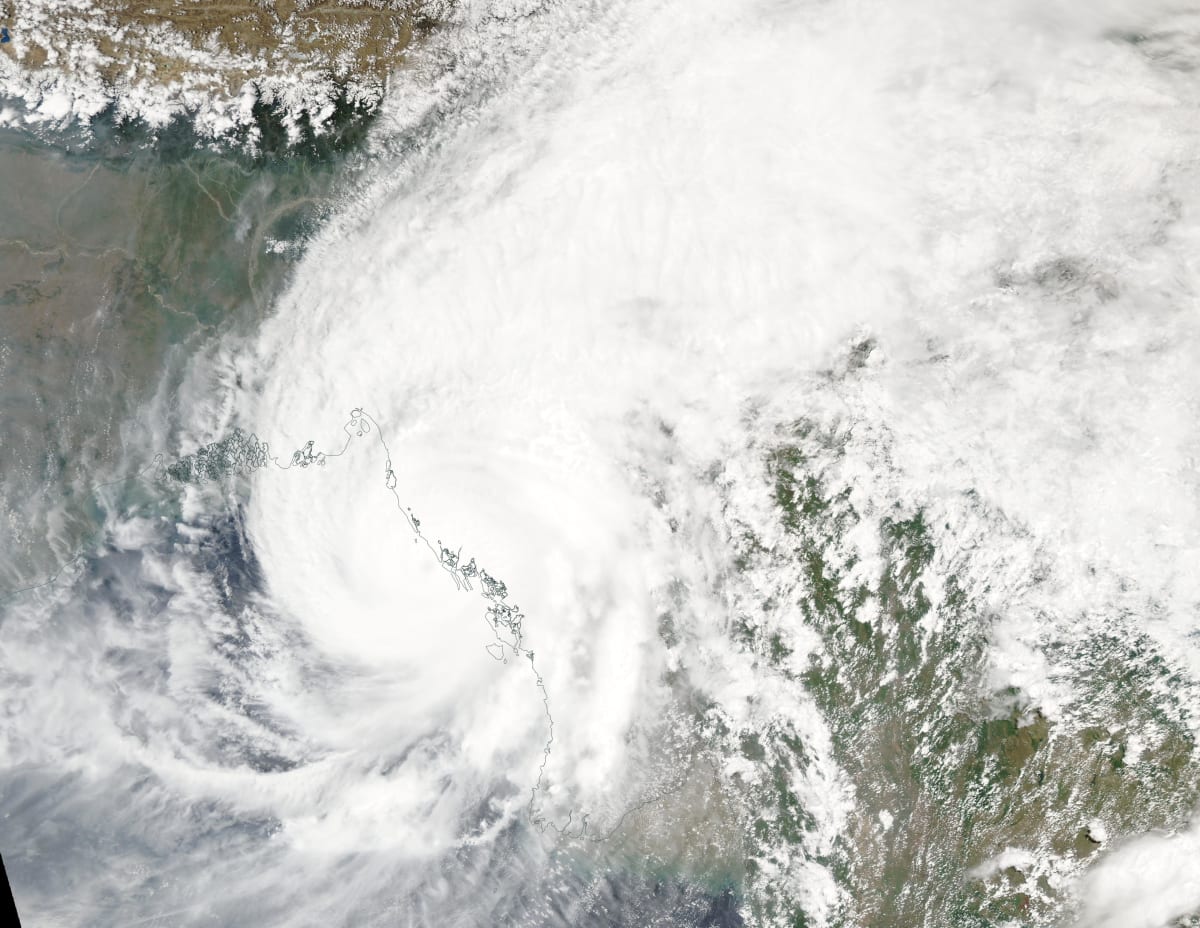
Odisha Red Alert: Deep Depression Triggers Mass Evacuations and Disaster Response

Red Warning Issued for Four Odisha Districts

On September 24, 2026, the India Meteorological Department (IMD) raised a red warning for the districts of Kandhamal, Gajapati, Rayagada and Koraput in Odisha. A deep depression over the Bay of Bengal has intensified, ushering relentless downpours that threaten flash floods, landslides and widespread deluge. The alert, which topped Google Trends under the query "today weather", has set off a rapid mobilisation of disaster‑response forces, with over 5,000 residents already evacuated to relief shelters.

Why the Alert Went Red

  • Pressure drop below 1005 hPa – a rare deep‑depression intensity for this time of year.
  • Rainfall forecasts of 200‑250 mm within 24 hours for the affected districts.
  • Topography – the Eastern Ghats and river basins amplify runoff, raising landslide risk.
  • Historical precedent – similar systems in 2019 and 2020 caused severe loss of life, prompting a more cautious stance.

"The red alert is a pre‑emptive measure. Our priority is to safeguard lives before the waters rise," said Dr. Ananya Rao, senior meteorologist at IMD, in a press briefing.

On‑Ground Response: Forces Mobilised

The state government has activated the Disaster Management Force (DMF), the National Disaster Response Force (NDRF), and the Odisha State Police. Key actions include:

  • Setting up 12 relief camps equipped with clean water, sanitation and medical aid.
  • Deploying 150 NDRF personnel with rescue boats and high‑water vehicles.
  • Pre‑positioning 2,000 sandbags along vulnerable riverbanks.
  • Launching a 24‑hour helpline for distress calls and real‑time updates.
  • Coordinating with NGOs like the Red Cross for food distribution.
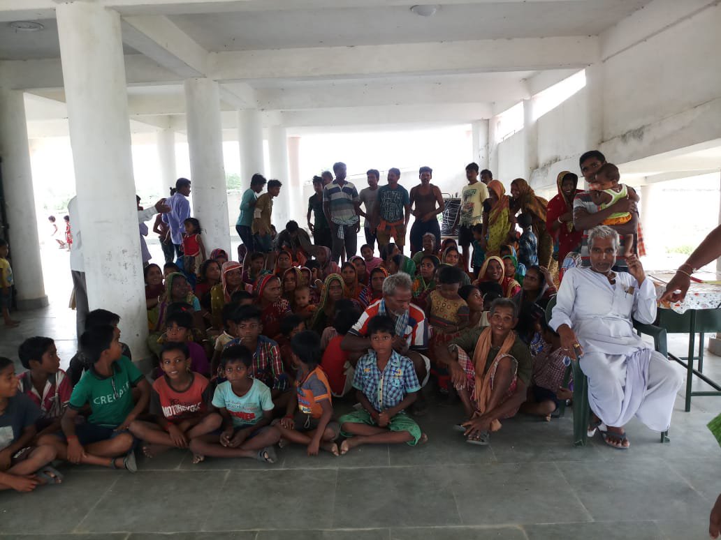
Odisha evacuation shelter Odisha evacuation shelter

Historical Context: Odisha’s Battle with Cyclones

Odisha sits on the cyclone‑prone east coast of India, bearing the brunt of some of the nation’s fiercest storms. The 1999 Super Cyclone claimed over 10,000 lives, reshaping the state’s disaster architecture. Since then, the State Disaster Management Authority (SDMA) has built a robust early‑warning network, integrating satellite data, community volunteers and mobile alerts. The current deep depression, while not yet a cyclonic storm, mirrors the atmospheric patterns that preceded Cyclone Arnab 2026, which later intensified into a Category‑2 system.

What Lies Ahead: Forecast and Preparedness

Meteorologists predict the depression will weaken into a low‑pressure area by Thursday, but residual moisture will keep rainfall intense for another 48‑72 hours. The IMD advises:

  • Stay indoors during heavy rain bursts.
  • Avoid low‑lying roads that may become inundated.
  • Follow official alerts on the Disaster Management app.
  • Prepare emergency kits with essentials (torch, batteries, first‑aid).

The proactive red alert has already reduced panic, allowing orderly evacuations and limiting potential casualties. However, experts warn that climate change may increase the frequency of such deep depressions, demanding continual upgrades to infrastructure and community resilience.


Key Takeaways

  • Red warning covers Kandhamal, Gajapati, Rayagada, Koraput.
  • Over 5,000 people moved to relief shelters.
  • DMF, NDRF, police on high alert with sandbags, boats, and helplines.
  • Historical cyclone experience informs current response.
  • Continued vigilance required as residual rains linger.

Stay tuned to official channels for live updates and safety instructions.


Original Reporting & Source: Google Trends (India)

Discussion (0)

Sign in to join the discussion.

No comments yet. Be the first to start the conversation!

| |

Odisha Red Alert: Deep Depression Triggers Mass Evacuations and Disaster Response

By Umang Sisodia • 3 min read • 9 views

Red Warning Issued for Four Odisha Districts

On September 24, 2026, the India Meteorological Department (IMD) raised a red warning for the districts of Kandhamal, Gajapati, Rayagada and Koraput in Odisha. A deep depression over the Bay of Bengal has intensified, ushering relentless downpours that threaten flash floods, landslides and widespread deluge. The alert, which topped Google Trends under the query "today weather", has set off a rapid mobilisation of disaster‑response forces, with over 5,000 residents already evacuated to relief shelters.

Why the Alert Went Red

  • Pressure drop below 1005 hPa – a rare deep‑depression intensity for this time of year.
  • Rainfall forecasts of 200‑250 mm within 24 hours for the affected districts.
  • Topography – the Eastern Ghats and river basins amplify runoff, raising landslide risk.
  • Historical precedent – similar systems in 2019 and 2020 caused severe loss of life, prompting a more cautious stance.

"The red alert is a pre‑emptive measure. Our priority is to safeguard lives before the waters rise," said Dr. Ananya Rao, senior meteorologist at IMD, in a press briefing.

On‑Ground Response: Forces Mobilised

The state government has activated the Disaster Management Force (DMF), the National Disaster Response Force (NDRF), and the Odisha State Police. Key actions include:

  • Setting up 12 relief camps equipped with clean water, sanitation and medical aid.
  • Deploying 150 NDRF personnel with rescue boats and high‑water vehicles.
  • Pre‑positioning 2,000 sandbags along vulnerable riverbanks.
  • Launching a 24‑hour helpline for distress calls and real‑time updates.
  • Coordinating with NGOs like the Red Cross for food distribution.

Odisha evacuation shelter Odisha evacuation shelter

Historical Context: Odisha’s Battle with Cyclones

Odisha sits on the cyclone‑prone east coast of India, bearing the brunt of some of the nation’s fiercest storms. The 1999 Super Cyclone claimed over 10,000 lives, reshaping the state’s disaster architecture. Since then, the State Disaster Management Authority (SDMA) has built a robust early‑warning network, integrating satellite data, community volunteers and mobile alerts. The current deep depression, while not yet a cyclonic storm, mirrors the atmospheric patterns that preceded Cyclone Arnab 2026, which later intensified into a Category‑2 system.

What Lies Ahead: Forecast and Preparedness

Meteorologists predict the depression will weaken into a low‑pressure area by Thursday, but residual moisture will keep rainfall intense for another 48‑72 hours. The IMD advises:

  • Stay indoors during heavy rain bursts.
  • Avoid low‑lying roads that may become inundated.
  • Follow official alerts on the Disaster Management app.
  • Prepare emergency kits with essentials (torch, batteries, first‑aid).

The proactive red alert has already reduced panic, allowing orderly evacuations and limiting potential casualties. However, experts warn that climate change may increase the frequency of such deep depressions, demanding continual upgrades to infrastructure and community resilience.


Key Takeaways

  • Red warning covers Kandhamal, Gajapati, Rayagada, Koraput.
  • Over 5,000 people moved to relief shelters.
  • DMF, NDRF, police on high alert with sandbags, boats, and helplines.
  • Historical cyclone experience informs current response.
  • Continued vigilance required as residual rains linger.

Stay tuned to official channels for live updates and safety instructions.


Original Reporting & Source: Google Trends (India)