Umang Sisodia • • 5 min read • 1 view

Low‑Pressure Surge Over the Bay of Bengal Signals Nationwide Rain Outlook
Listen to Article
Select a voice and press play
Low‑Pressure Surge Over the Bay of Bengal Signals Nationwide Rain Outlook

Key Takeaways

  • A nascent low‑pressure system over the Bay of Bengal is poised to bring scattered showers across most Indian states.
  • Meteorologists warn that while rain chances rise, large swathes may still experience dry conditions, especially in central India.
  • The development has spiked Google searches for "বৃষ্টি" (rain) with over 200 daily queries, reflecting heightened public anxiety.
  • Agricultural sectors and water‑resource planners are closely monitoring the system for early‑season irrigation decisions.

Overview of the Emerging Low‑Pressure System

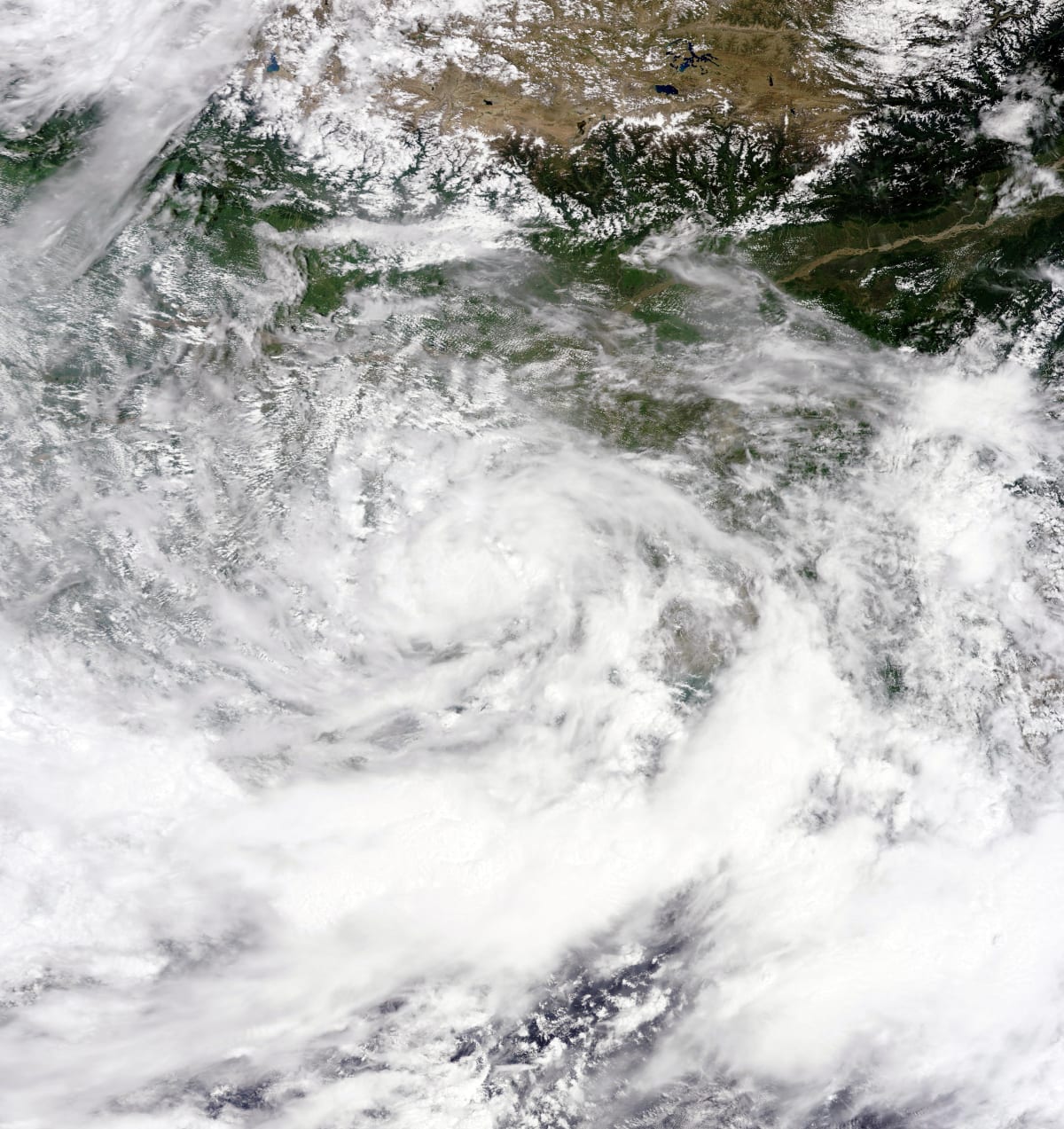
The Indian Ocean’s eastern arm, the Bay of Bengal, has long acted as a cradle for monsoonal disturbances. On October 22, satellite imagery captured a subtle dip in atmospheric pressure—commonly termed a “low‑pressure trough”—south of the Indian coastline. This trough is gradually deepening, a classic precursor to convection and rain‑bearing clouds.

According to the India Meteorological Department (IMD), the system is expected to intensify over the next 48‑72 hours, drifting westward towards the Indian subcontinent. The IMD’s latest bulletin (issued at 06:00 IST) notes a central pressure of 1008 hPa, a figure low enough to trigger uplift of moist air masses.

"The emerging low over the Bay of Bengal is expected to generate moderate to heavy rainfall in the coastal belts of West Bengal, Odisha, and Andhra Pradesh, with possible spill‑over into interior districts," – IMD spokesperson, quoted by thenews24.com.

Regional Meteorological Forecasts

Region Expected Rainfall Temperature Impact
West Bengal & Odisha 30‑70 mm (scattered to moderate) Slight dip of 1‑2 °C
Andhra Pradesh & Telangana 20‑50 mm (isolated showers) Minor cooling in evenings
Central India (Madhya Pradesh, Chhattisgarh) Dry – high pressure dominance Temperatures remain above 30 °C
North‑East (Assam, Meghalaya) 40‑80 mm (potentially heavy) Cooling of up to 3 °C

The dual nature of the forecast—rain in the east and dryness in the centre—explains the surge in Google searches for "বৃষ্টি". Citizens in rain‑prone states are scrambling for updates, while those in the drier belt are equally eager to know whether relief is on the horizon.

Public Response and Agricultural Implications

Farmers in West Bengal’s Hooghly district have already begun pre‑emptive sowing of kharif crops, hoping the anticipated showers will replenish soil moisture. Conversely, agronomists in Madhya Pradesh warn that persistent dryness could jeopardise the upcoming wheat sowing window, urging irrigation authorities to mobilise groundwater resources.

Social media platforms are awash with user‑generated content: videos of darkening skies over Kolkata, photos of water‑logged streets in Bhubaneswar, and TikTok clips of villagers performing traditional rain‑calling rituals. The viral nature of such posts fuels the Google Trends spike, creating a feedback loop between media coverage and public curiosity.

Expert Opinions

Meteorologist Dr. Ananya Singh of the Indian Institute of Tropical Meteorology (IITM) emphasizes that the system is not a full‑blown cyclonic storm, but rather a monsoonal trough that can still deliver significant rainfall:

"While the pressure gradient is modest, the moisture content over the Bay is exceptionally high this season. Even a weak trough can dump 50‑80 mm of rain in a short span, enough to trigger flash floods in low‑lying areas."

Dr. Singh also notes a long‑term trend: the Bay of Bengal’s low‑pressure systems are forming earlier in the season, possibly linked to warmer sea‑surface temperatures and altered jet‑stream patterns.

rainfall in Indian villages rainfall in Indian villages

Comparative Outlook: Dry Spell vs. Rain‑Boost

The juxtaposition of dry conditions in central India against rain prospects in the east underscores a broader climatic dichotomy. Historically, the Indian monsoon exhibits a west‑east gradient, but recent years have shown increased variability. This variability is reflected in the divergent headlines:

  • "বঙ্গোপসাগরে লঘুচাপের আভাস, সারা দেশে বৃষ্টির সম্ভাবনা" (Amader Barta) – highlighting the nationwide rain potential.
  • "সারাদেশের আবহাওয়া শুষ্ক থাকতে পারে" (দৈনিক এদিন) – cautioning that the overall picture may still be dry.

The coexistence of these narratives is a hallmark of the “monsoon paradox”, where localized rain events coexist with macro‑scale dryness.

  1. Real‑time alerts from regional news portals and the IMD’s mobile app have been shared extensively on WhatsApp groups.
  2. Agricultural advisories issued by state governments prompt farmers to check forecasts multiple times a day.
  3. Urban commuters in megacities like Kolkata and Chennai monitor rain forecasts to plan travel, leading to frequent search queries.

The confluence of these factors explains why the simple Bengali keyword "বৃষ্টি" has crossed the 200‑search threshold, a notable figure for a single‑word query.

Editorial Analysis & Future Outlook

The emerging low‑pressure system over the Bay of Bengal serves as a microcosm of India’s evolving climate narrative. In the short term, it will deliver much‑needed rain to the eastern corridor, potentially alleviating short‑term water stress for agriculture and urban water reservoirs. However, the persistent dryness in central India signals that regional imbalances will likely intensify unless water‑management policies adapt swiftly.

Looking ahead, climatologists anticipate more frequent, albeit weaker, troughs as sea‑surface temperatures rise. This could translate into higher inter‑annual variability—a scenario that challenges traditional monsoon forecasting models. Stakeholders—ranging from policymakers to farmers—must invest in hyper‑local weather monitoring and climate‑resilient cropping patterns to navigate this new normal.

In the digital age, the speed at which weather information spreads (as evidenced by the Google Trends surge) underscores the need for accurate, timely, and accessible communication from meteorological agencies. Failure to do so could amplify public anxiety, disrupt economic activities, and erode trust in institutions.

Ultimately, the Bay of Bengal low‑pressure episode is a reminder that India’s climate system is in flux. While a single rain event may not rewrite the monsoon story, it offers a critical data point for scientists and a momentary reprieve for rain‑dependent communities. The real test will be how the nation translates these episodic insights into long‑term resilience strategies.


Original Reporting & Source: Google Trends (India)

Discussion (0)

Sign in to join the discussion.

No comments yet. Be the first to start the conversation!

| |

Low‑Pressure Surge Over the Bay of Bengal Signals Nationwide Rain Outlook

By Umang Sisodia • 5 min read • 1 view

Key Takeaways

  • A nascent low‑pressure system over the Bay of Bengal is poised to bring scattered showers across most Indian states.
  • Meteorologists warn that while rain chances rise, large swathes may still experience dry conditions, especially in central India.
  • The development has spiked Google searches for "বৃষ্টি" (rain) with over 200 daily queries, reflecting heightened public anxiety.
  • Agricultural sectors and water‑resource planners are closely monitoring the system for early‑season irrigation decisions.

Overview of the Emerging Low‑Pressure System

The Indian Ocean’s eastern arm, the Bay of Bengal, has long acted as a cradle for monsoonal disturbances. On October 22, satellite imagery captured a subtle dip in atmospheric pressure—commonly termed a “low‑pressure trough”—south of the Indian coastline. This trough is gradually deepening, a classic precursor to convection and rain‑bearing clouds.

According to the India Meteorological Department (IMD), the system is expected to intensify over the next 48‑72 hours, drifting westward towards the Indian subcontinent. The IMD’s latest bulletin (issued at 06:00 IST) notes a central pressure of 1008 hPa, a figure low enough to trigger uplift of moist air masses.

"The emerging low over the Bay of Bengal is expected to generate moderate to heavy rainfall in the coastal belts of West Bengal, Odisha, and Andhra Pradesh, with possible spill‑over into interior districts," – IMD spokesperson, quoted by thenews24.com.

Regional Meteorological Forecasts

Region Expected Rainfall Temperature Impact
West Bengal & Odisha 30‑70 mm (scattered to moderate) Slight dip of 1‑2 °C
Andhra Pradesh & Telangana 20‑50 mm (isolated showers) Minor cooling in evenings
Central India (Madhya Pradesh, Chhattisgarh) Dry – high pressure dominance Temperatures remain above 30 °C
North‑East (Assam, Meghalaya) 40‑80 mm (potentially heavy) Cooling of up to 3 °C

The dual nature of the forecast—rain in the east and dryness in the centre—explains the surge in Google searches for "বৃষ্টি". Citizens in rain‑prone states are scrambling for updates, while those in the drier belt are equally eager to know whether relief is on the horizon.

Public Response and Agricultural Implications

Farmers in West Bengal’s Hooghly district have already begun pre‑emptive sowing of kharif crops, hoping the anticipated showers will replenish soil moisture. Conversely, agronomists in Madhya Pradesh warn that persistent dryness could jeopardise the upcoming wheat sowing window, urging irrigation authorities to mobilise groundwater resources.

Social media platforms are awash with user‑generated content: videos of darkening skies over Kolkata, photos of water‑logged streets in Bhubaneswar, and TikTok clips of villagers performing traditional rain‑calling rituals. The viral nature of such posts fuels the Google Trends spike, creating a feedback loop between media coverage and public curiosity.

Expert Opinions

Meteorologist Dr. Ananya Singh of the Indian Institute of Tropical Meteorology (IITM) emphasizes that the system is not a full‑blown cyclonic storm, but rather a monsoonal trough that can still deliver significant rainfall:

"While the pressure gradient is modest, the moisture content over the Bay is exceptionally high this season. Even a weak trough can dump 50‑80 mm of rain in a short span, enough to trigger flash floods in low‑lying areas."

Dr. Singh also notes a long‑term trend: the Bay of Bengal’s low‑pressure systems are forming earlier in the season, possibly linked to warmer sea‑surface temperatures and altered jet‑stream patterns.

rainfall in Indian villages rainfall in Indian villages

Comparative Outlook: Dry Spell vs. Rain‑Boost

The juxtaposition of dry conditions in central India against rain prospects in the east underscores a broader climatic dichotomy. Historically, the Indian monsoon exhibits a west‑east gradient, but recent years have shown increased variability. This variability is reflected in the divergent headlines:

  • "বঙ্গোপসাগরে লঘুচাপের আভাস, সারা দেশে বৃষ্টির সম্ভাবনা" (Amader Barta) – highlighting the nationwide rain potential.
  • "সারাদেশের আবহাওয়া শুষ্ক থাকতে পারে" (দৈনিক এদিন) – cautioning that the overall picture may still be dry.

The coexistence of these narratives is a hallmark of the “monsoon paradox”, where localized rain events coexist with macro‑scale dryness.

  1. Real‑time alerts from regional news portals and the IMD’s mobile app have been shared extensively on WhatsApp groups.
  2. Agricultural advisories issued by state governments prompt farmers to check forecasts multiple times a day.
  3. Urban commuters in megacities like Kolkata and Chennai monitor rain forecasts to plan travel, leading to frequent search queries.

The confluence of these factors explains why the simple Bengali keyword "বৃষ্টি" has crossed the 200‑search threshold, a notable figure for a single‑word query.

Editorial Analysis & Future Outlook

The emerging low‑pressure system over the Bay of Bengal serves as a microcosm of India’s evolving climate narrative. In the short term, it will deliver much‑needed rain to the eastern corridor, potentially alleviating short‑term water stress for agriculture and urban water reservoirs. However, the persistent dryness in central India signals that regional imbalances will likely intensify unless water‑management policies adapt swiftly.

Looking ahead, climatologists anticipate more frequent, albeit weaker, troughs as sea‑surface temperatures rise. This could translate into higher inter‑annual variability—a scenario that challenges traditional monsoon forecasting models. Stakeholders—ranging from policymakers to farmers—must invest in hyper‑local weather monitoring and climate‑resilient cropping patterns to navigate this new normal.

In the digital age, the speed at which weather information spreads (as evidenced by the Google Trends surge) underscores the need for accurate, timely, and accessible communication from meteorological agencies. Failure to do so could amplify public anxiety, disrupt economic activities, and erode trust in institutions.

Ultimately, the Bay of Bengal low‑pressure episode is a reminder that India’s climate system is in flux. While a single rain event may not rewrite the monsoon story, it offers a critical data point for scientists and a momentary reprieve for rain‑dependent communities. The real test will be how the nation translates these episodic insights into long‑term resilience strategies.


Original Reporting & Source: Google Trends (India)